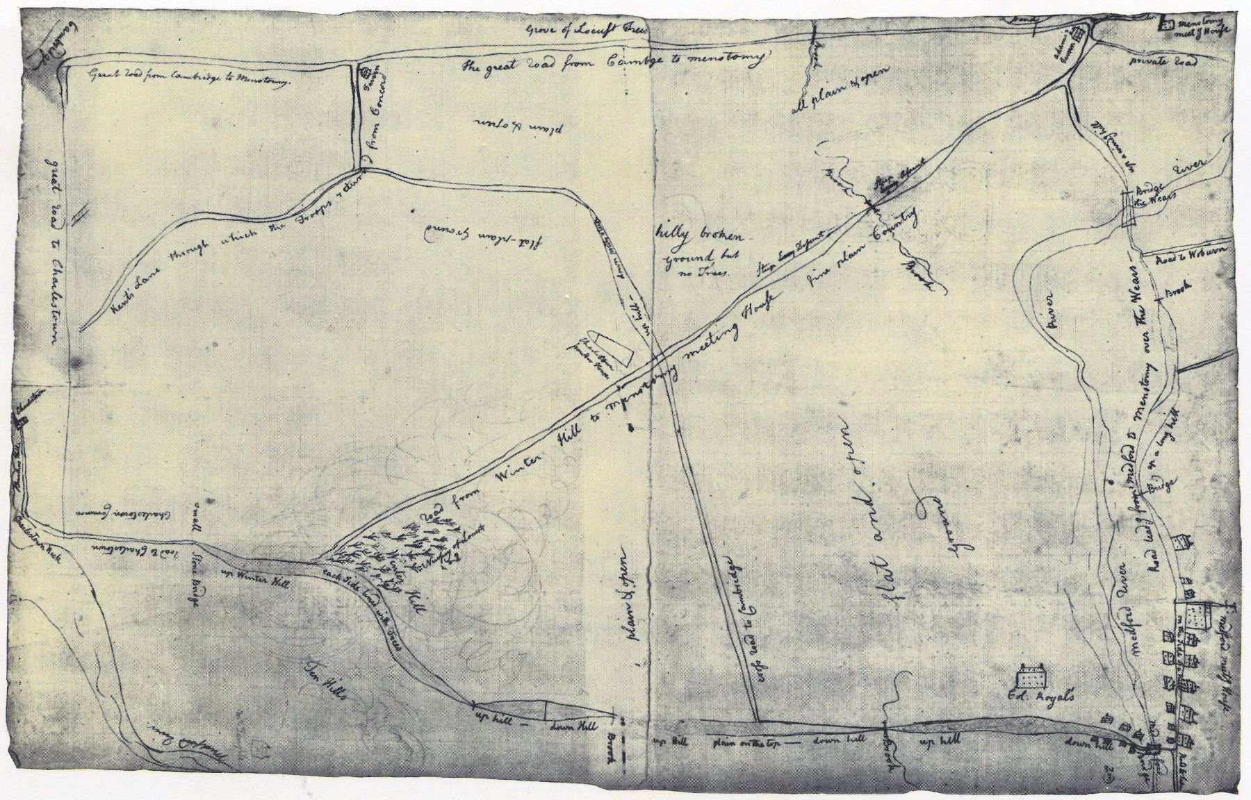
A Sketch from the Time Gives Key Information about Lexington and Concord.

This pencil sketch was done right after the fighting shows the Menotomy-Cambridge road as a straight line across the bottom. At a tavern at the edge of Cambridge, Percy, sensing an ambush ahead, wheeled left into Kent’s Lane toward Charlestown.
Return to “Rediscovering Hand-Drawn Maps from the Revolution and the English Duke Who Collected Them” by Edwin S. Grosvenor, American Heritage, Summer 2019.
Return to “The Treasure of Alnwick Castle” by Elizabeth and William Cumming, American Heritage, August 1969.
From: Rediscovering Hand-Drawn Maps from the American Revolution and the Duke Who Collected Them | Summer 2019,
Volume: 64, No: 3
